

50s and 60s! Another cool night in store for Central Florida

Weather Forecast: November 18, 2020
FOX 35 Chief Meteorologist Glenn Richards gives you the latest on the weather in Central Florida.
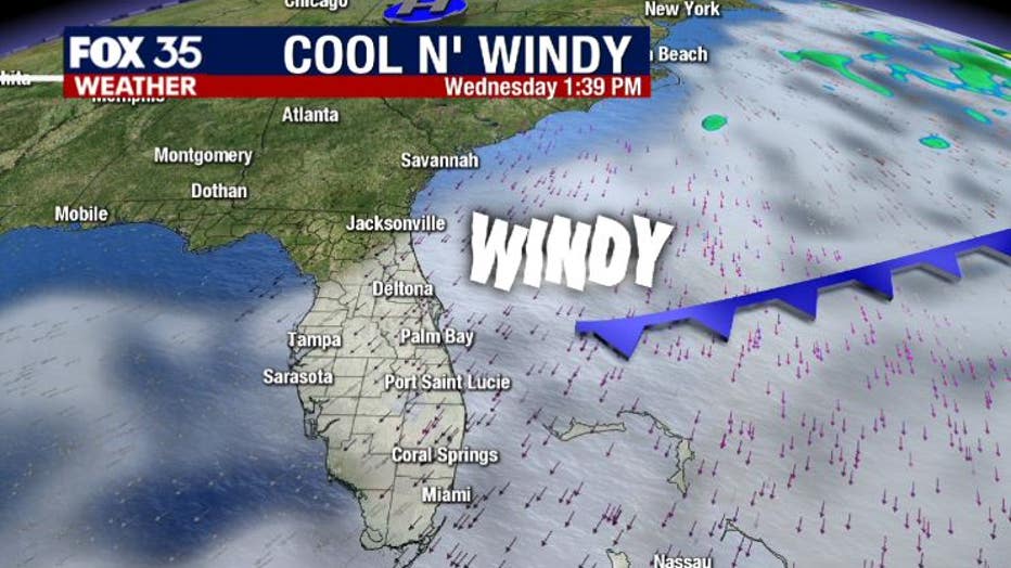
Orlando, fl - A second, weak cool front will graze Central Florida today as it moves off the Atlantic seaboard.
This means a reinforcing shot of cooler air for the area and very gusty winds. Aside from the delightful temps, the gusty winds setting up today will really take center stage in the local weather headlines. Expect sustained winds around 20mph with gusts hitting near 25-30mph this afternoon.
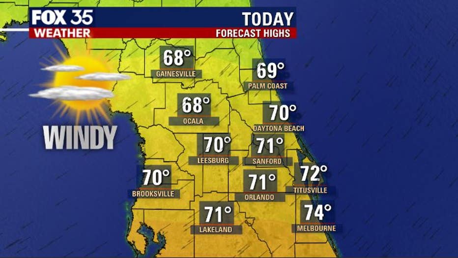
High temps today will make it to near 70 degrees across the Orlando Metro, upper 60s likely across North Central Florida.
Skies will feature some extra clouds blowing in off the Atlantic and don't rule out a few isolated sprinkles or showers mainly across the coastal counties. Overall, it looks like a decent day and our comfort meter shows a good solid reading around a 9 or so.

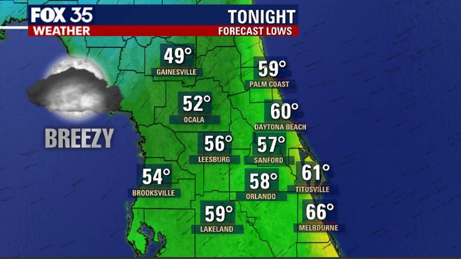
Tonight, winds remain fairly elevated, enough to call it breezy through the overnight hours. Scattered clouds can be expected and even a coastal shower.
Lows will tumble to near 50 over the North Central portions of the viewing area and 50s and 60s South of that.
WEATHER ALERTS: Download the FOX 35 Weather App to track the tropics on your phone, receive severe weather alerts, and get the latest daily forecasts