

Central Florida to see near-record heat ahead of weekend cold front

Weather Forecast: February 18, 2021
FOX 35 Chief Meteorologist Glenn Richards has the latest on the weather in Central Florida.
ORLANDO, Fla. - Near-record warmth has set up over Florida, with high temperatures on Thursday in Orlando soaring to around 85 degrees. A record for the date is 87.
The remainder of the viewing area saw similar temps, and humidity was on the higher side of the spectrum.
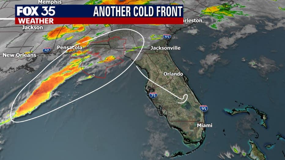
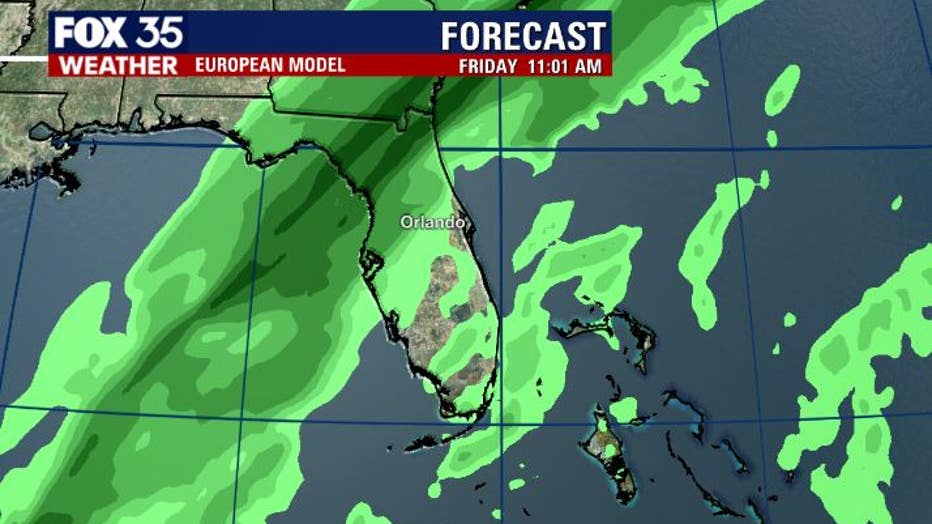
A cold front located in the Panhandle has steadily been moving towards our viewing area. Our rain chances around the Central Peninsula will rise as we head into Friday morning.
Expect a decent run of showers and a few isolated storms producing some gusty winds and a rumble of thunder. Timing appears to be around 7 a.m. Friday morning with rain coverage continuing well into the afternoon and evening.
WEATHER ALERTS: Download the FOX 35 Weather App for live radar, severe weather alerts, and daily forecast reports on your phone
Lows will drop off to levels we have not seen in a while. The warmest readings will be down in south Brevard County and the coolest readings will be in the 40s up near Ocala and Gainesville.
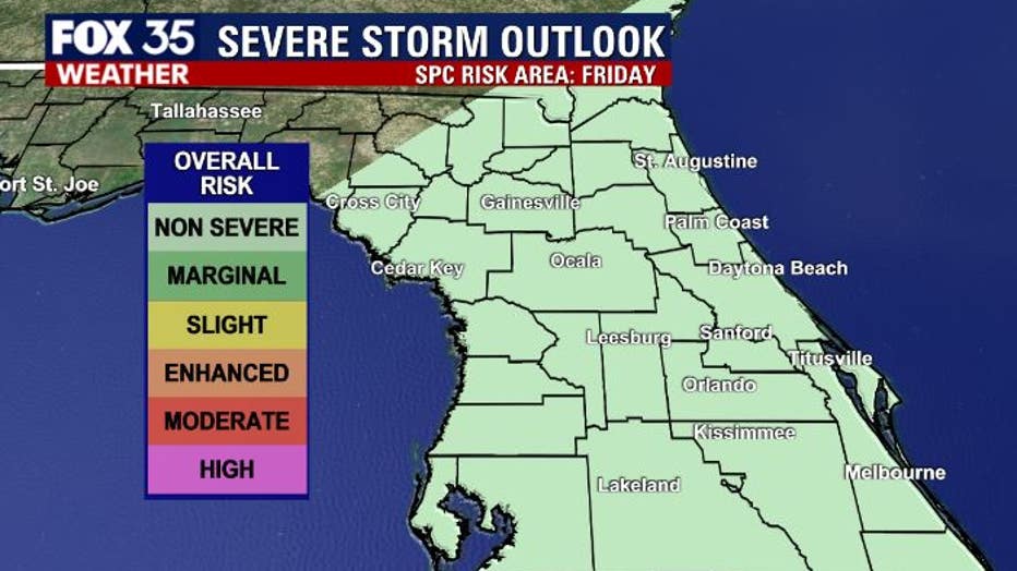
The current severe weather outlook from the Storm Prediction Center has Florida in a "non-severe" risk area which is always welcomed news!
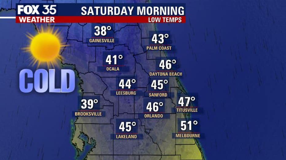
Behind the front late Friday night into Saturday morning will bring some chilly but beautiful weather back to Florida. A look at wake-up temps Saturday morning shows a mix of 30s and 40s under a canopy of full sun.
Weekend highs will range between 65-70 degrees, enjoy the gorgeous slice of weather!
Watch FOX 35 News for the latest weather updates.