

Central Florida wakes up to 50s, 60s after cool front: What's next

Weather Report: October 18, 2021
FOX 35 Storm Team Chief Meteorologist Jayme King gives the latest on the weather in Central Florida.
ORLANDO, Fla. - It's finally here: the taste of fall that many have craved after a long and hot summer in Central Florida.
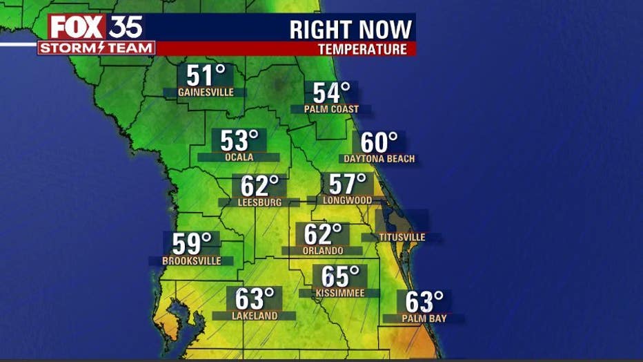
Early morning temperatures on Monday were down — "we mean way down compared to the last several mornings," FOX 35 Storm Team Chief Meteorologist Jayme King said.
North Central Florida fell briefly into the upper 40s near Gainesville while the rest of Central Florida hit the 50s and 60s.
WEATHER ALERTS: Download the FOX 35 Storm Team Weather app for live radar, severe weather alerts, and daily forecast reports on your phone
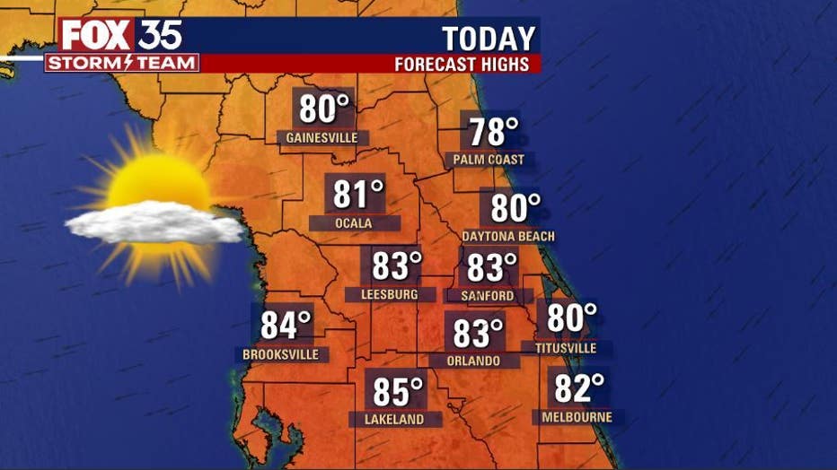
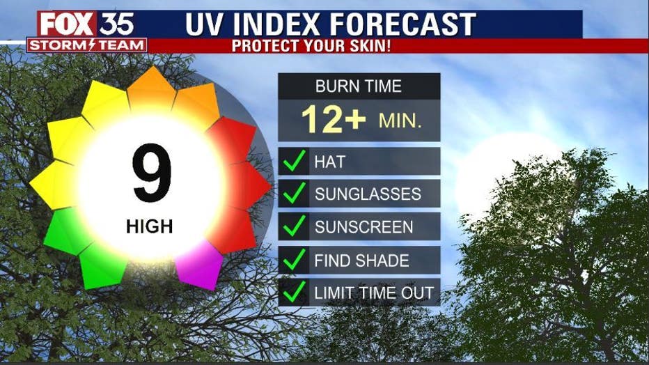
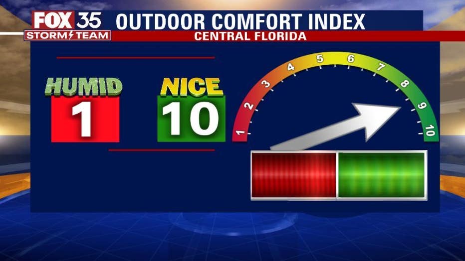
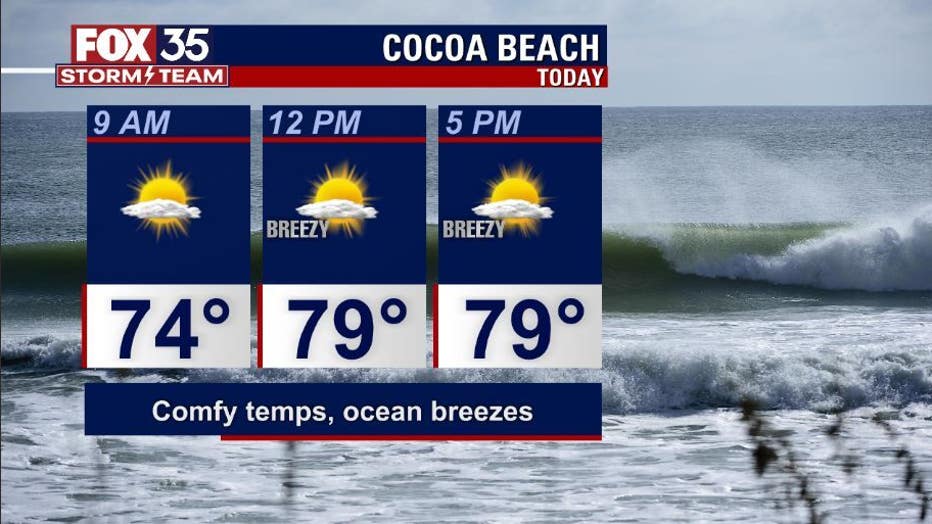
The day ahead is expected to have fantastic weather from the coast to the interior of the region. Highs will hit near 80 degrees in most locations with sunshine prevailing. The U.V. Index forecast will be high as well, around 9 or 10. So, protect your skin if you are out and about.
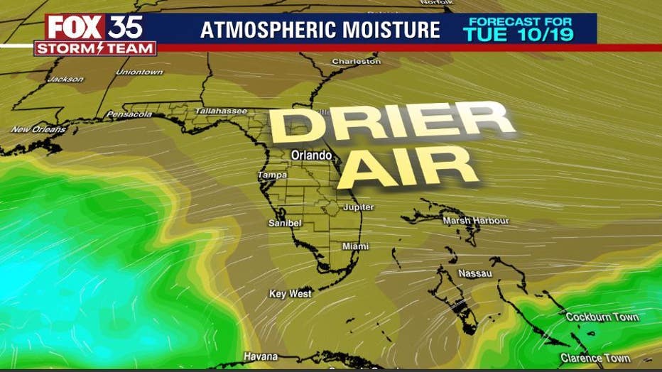
The air is quite dry so rain chances are out of the forecast for Monday and the next few days. The latest forecast models coming into the FOX 35 Storm Center are showing the dry air layer sticking around at least through midweek. So, if you have got plans outside, enjoy. However, for those along the coast, note that the rip current risk is fairly high on Monday.
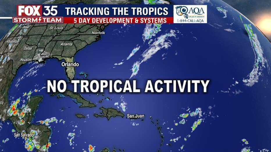
TRACK THE TROPICS: Visit the FOX 35 Storm Team Hurricane Center for the latest tropical weather outlook and more
Meanwhile, the tropics remain quiet as the final weeks of the 2021 Atlantic Hurricane Season are underway. Tropical storm formation is not expected anywhere in the Atlantic basin for at least the next five days.
Watch FOX 35 Orlando for the latest weather updates.