

Could Florida be a heavy rain target in coming days?

Weather Forecast: April 15, 2021
FOX 35 Storm Team Chief Kristin Giannas has the latest on the weather in Central Florida.
Orlando, FL - After a few quiet weather days, the trend of stormy Florida weather will continue as we head through the next few days.
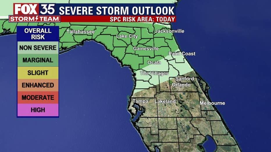
On Thursday, the first in a series of systems will move into the Florida Panhandle by this afternoon. Areas in North Central Florida should be weather aware, especially after 2 p.m. A few strong or isolated severe storms will be possible.
The Storm Prediction Center has a good chunk of North Florida in a "MARGINAL" risk of severe weather today. Damaging winds and even some small hail look to be the main issues.
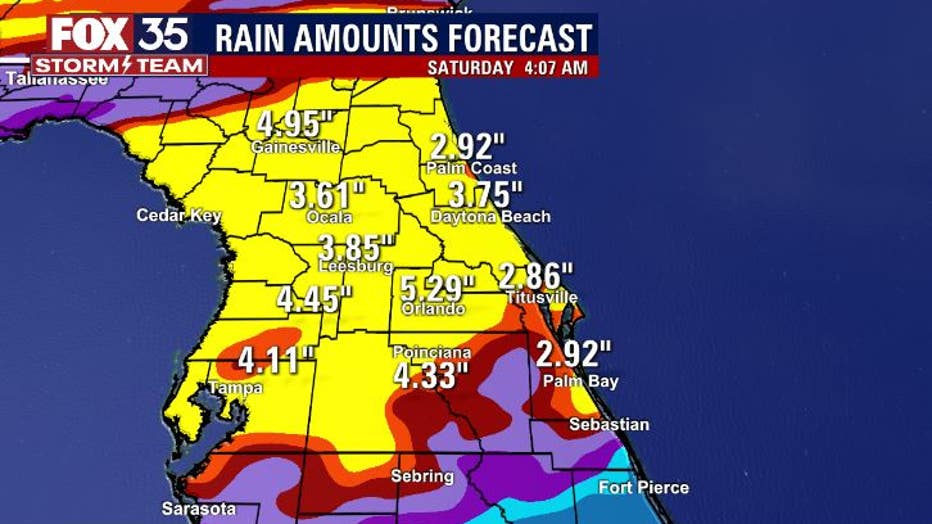
Late this coming weekend, a front will move into Florida and stall out. Moisture will gather along the front and heavy rainfall could potentially result.
While Saturday looks like a mainly dry day, Sunday appears to be a different story.
Sunday rainfall could begin before 12 p.m. for areas around Orlando and Northward into Southern Georgia. Right now, it looks like the risk of severe weather will be very low, heavy areas of rainfall seem more likely.
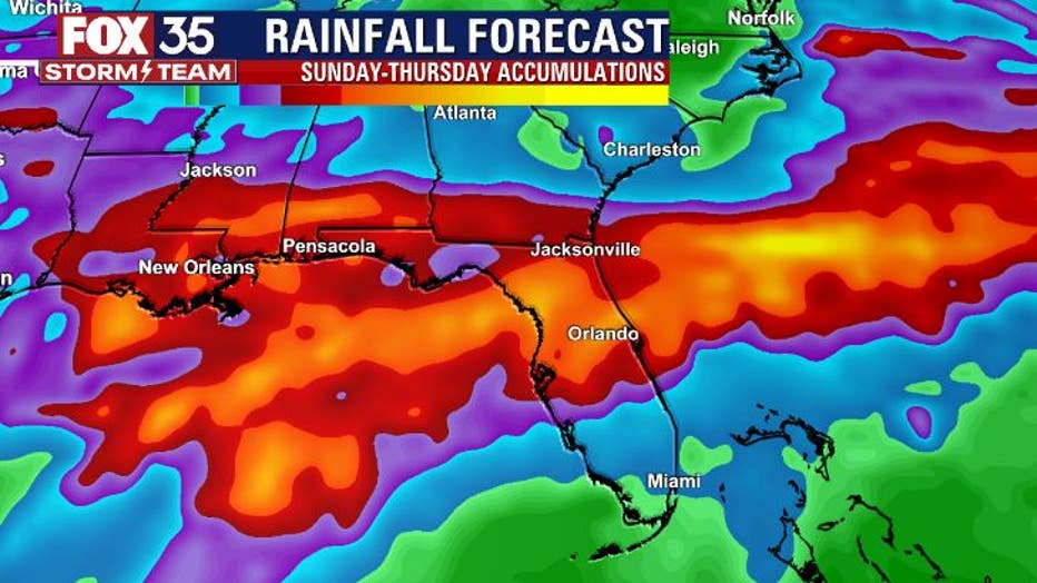
When we compare two of the more reliable rainfall models, the European and the GFS, both are generating very similar rain amounts from this Sunday through Thursday of next week.
WEATHER ALERTS: Download the FOX 35 Storm Team Weather App for live radar, severe weather alerts, and daily forecast reports on your phone
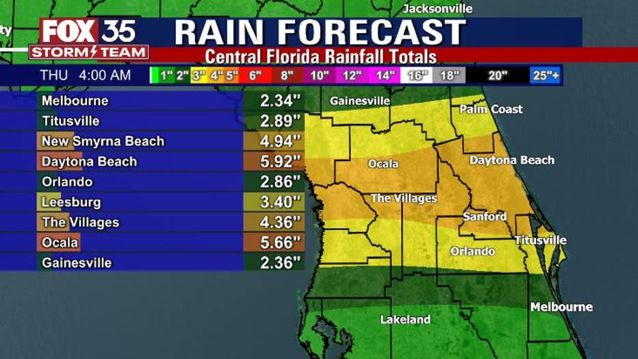
The GFS has been advertising a wetter outlook since Tuesday, the European really jumped onboard yesterday. When you see a signal of wetter weather coming from both of these forecast models, it's time to pay attention! Both models show rainfall amounts generally in the 3-5" range longer term for the Central Peninsula.
The coming days could bring a FOX 35 STORM ALERT DAY so stay with us as we track the rain and storm chances from late this weekend through much of next week!
Watch FOX 35 News for the latest weather updates.