

High heat and lower rain chances heading into the weekend

Orlando, FL - We have made it to the weekend and it is going to be a hot and humid one.
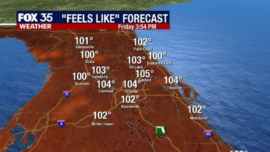
Afternoon highs across the interior will reach the mid-90s, and in the low-90s along the coast. The FOX 35 Storm Team is tracking heat index readings ranging from 101 to 106 degrees across East Central Florida through the weekend. If you have any outdoor plans, pack plenty of water, apply sunscreen generously and take breaks in the A/C if you can!
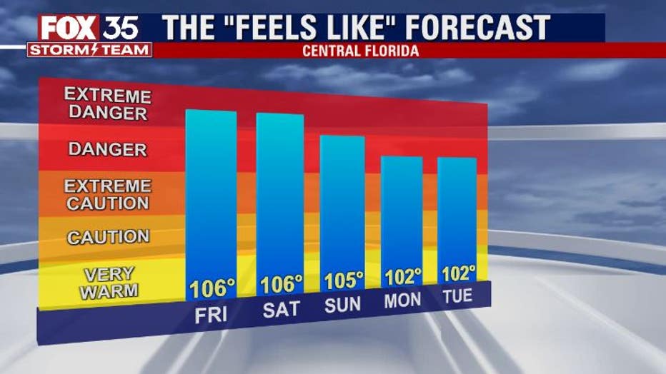
The heat index will remain elevated through the weekend, remaining in the 106° range during the afternoon hours. Rain chances will also remain limited in most cases, so an afternoon cooldown will be in the cards for only select areas. Some locations may not see a single drop of rain!
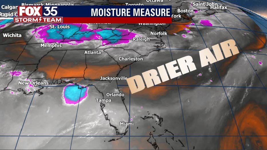
Drier air is currently invading the state and evident on the FOX 35 Storm Team's "Moisture Measure". The dry air will scour out some of the tropical moisture that has dominated the area for days on end. Simply stated: dry air means hotter temps and lower overall rain chances.
WEATHER ALERTS: Download the FOX 35 Storm Team Weather app for live radar, severe weather alerts, and daily forecast reports on your phone
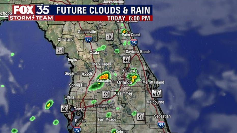
Forecast modeling shows fairly isolated rain coverage this afternoon. Current coverage stands at 40% at max peak for the p.m. hours. Areas that do see some rain action can expect heavy downpours, lightning and some gusty breezes.
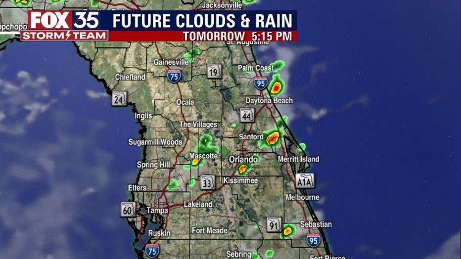
Saturday and Sunday will also offer up somewhat limited rain chances as well, with 40% coverage at peak for the afternoon hours with some locations remaining hot and dry all day.
Stay with the Fox 35 Storm Team over the weekend for the very latest!