

Major chill prompts Freeze Warnings tonight for Central Florida

ORLANDO, Fla. - Central Florida started off with a Wind Chill Advisory until 9 a.m. on Tuesday morning ahead of a much chillier night.
Cloud cover this morning will gradually thin shortly after sunrise. Feels like temps or "wind chill factor" will remain in the upper 20s to lower 30s early, bundle up if heading outdoors!
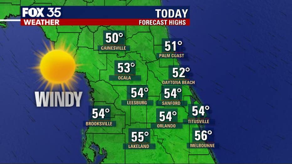
Temperatures will eventually warm but, not much by this afternoon. Expect a range between 50-54 degrees. Sunshine is on our side today but, winds will remain quite gusty, adding to the chill.
Wind gusts could approach the 30mph mark with ease today, easing a bit by late afternoon and evening.
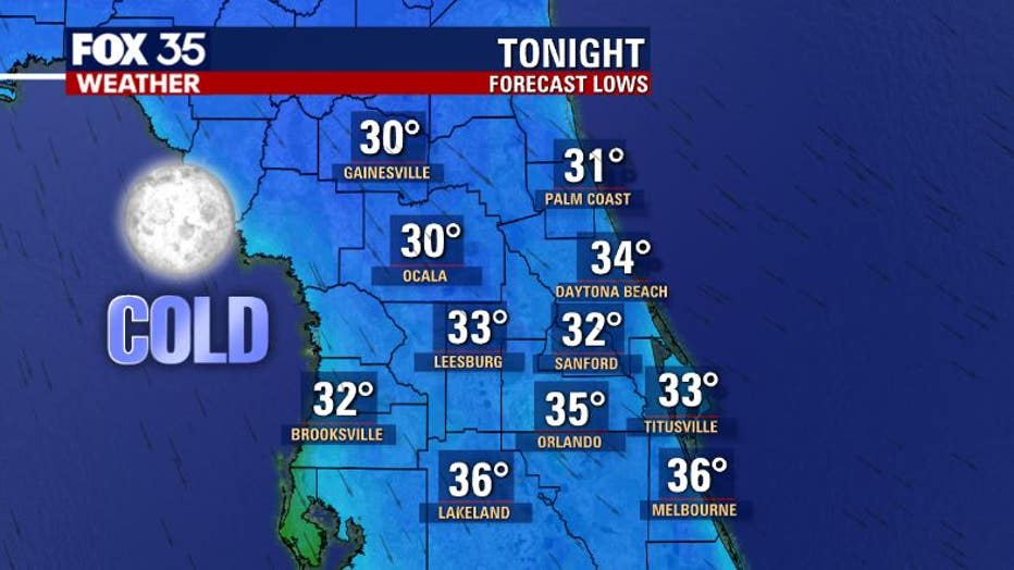
Temperatures really take a dive Tuesday night into Wednesday morning under a canopy of clear skies. Light breezes are expected, adding to the chill. Many locations North of Orlando will experience the coldest overnight lows since early January.
Freeze warnings are now in effect for areas North of Metro Orlando. This could possibly change with the chance of a freeze closer to Orlando. We will continue updating you from the FOX 35 Weather Center as new information comes in.
WEATHER ALERTS: Download the FOX 35 Weather App to track the tropics on your phone, receive severe weather alerts, and get the latest daily forecasts
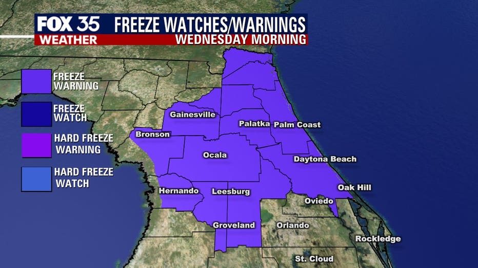
As of 4 a.m. Tuesday morning, the current freeze warning includes, Interior Volusia County, Lake, Flagler, Marion, Sumter, Alachua, Inland Levy and Putnam Counties. Again, this could change later today so, stay on top of the forecast.
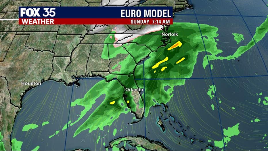
Yet another front will approach Florida during the coming weekend. While it doesn't look as cold, current forecast modeling is suggesting some weekend rainfall. Something to watch as we draw closer. Stay tuned!
Watch FOX 35 for the latest weather updates.