

NHC: Forecasters watching Caribbean Sea for tropical development

Tracking the Tropics: June 8, 2021
FOX 35 Storm Team Chief Meteorologist Jayme King has your forecast.
ORLANDO, Fla. - It looks like another hot, sweaty day for Central Florida.
Expect area highs to stay in the 80s along the beaches with a fresh Atlantic sea breeze developing. Inland, temps will trend hotter and in the 90s. The local air will also have that muggy, sticky feel. Skies will feature mixed conditions with clouds streaming by for much of the day.
WEATHER ALERTS: Download the FOX 35 Storm Team Weather app for live radar, severe weather alerts, and daily forecast reports on your phone
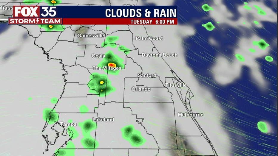
The rainfall forecast for the viewing area doesn't look great for the next few days. Moisture count remains relatively low so in turn, rain chances remain low.
RELATED: These locations named most at risk for 2021 Atlantic hurricane season
Looks like the coastal areas will stay in the dry zone, but west of I-95 will be a different story. Chances will jump up over the interior mainly after 2 p.m. While coverage will be low, expect a few isolated showers or storms with chances at 30% or less overall.
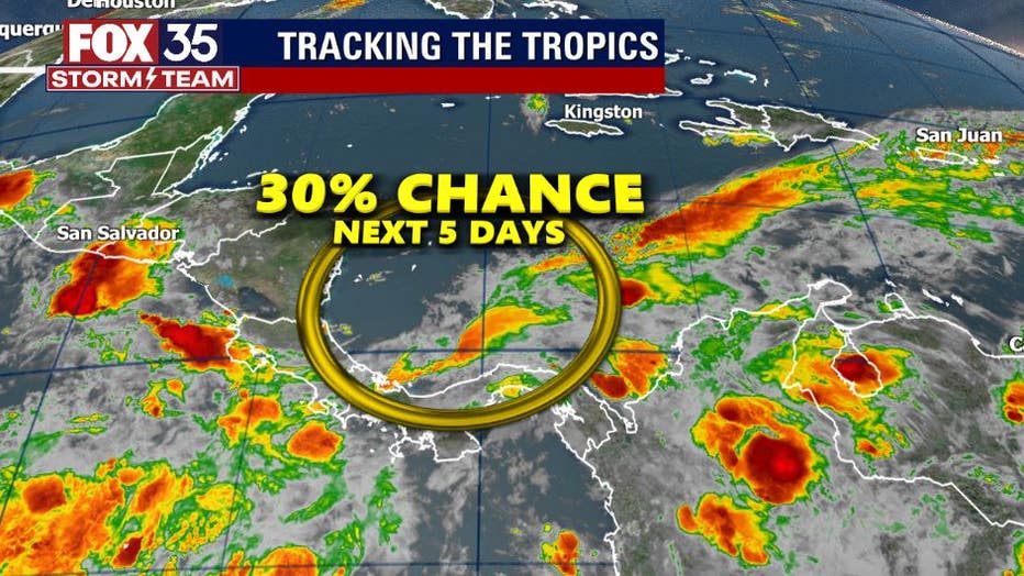
The FOX 35 Storm Team is currently monitoring an area of broad spin down near Central America in the Southwest Caribbean.
The National Hurricane Center gives this feature a 30% chance of development over the next 5 days. For now, we will continue to watch this area and update you as the changes come.
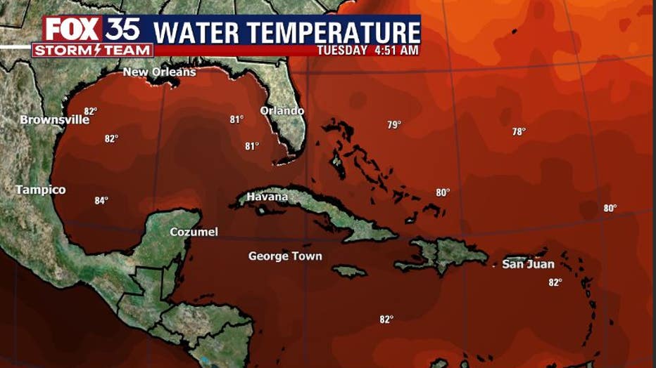
Water temperatures across the tropics also continue their seasonal rise with some of the warmest sea surface temperatures located over the Western Gulf and Central Caribbean.
Stay with us for the very latest concerning the tropics, the FOX 35 STORM TEAM has you covered!