

Orlando Weather Forecast: Hot Monday with afternoon showers, storms

Weather Forecast: September 12, 2022
FOX 35 storm team Meteorologist Brooks Garner has a look at this week's forecast
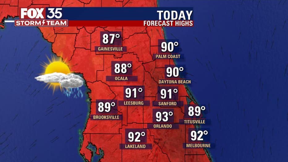
Today's high: 93 degrees | Tonight's low: 75 degrees | Rain: 80% chance PM Storms
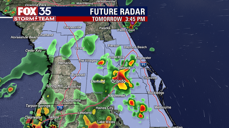
Main weather concerns: A quiet start to our Monday turns active by this afternoon. Showers and storms return mainly after 2 p.m. for most locations. Could be a few showers closer to the coast just after 11 a.m. as the sea breeze ignites and moves steadily inland.
Rain chances peak as high as 80% over the inland counties, a hair lower at 60% or so along the beaches. High temps move into the lower 90s for areas inland, and upper 80s at the beach. Storm threats include heavy rain, gusty winds and plenty of lightning strikes.
BEACHES
Looks like a decent day to visit the beaches, just watch for PM storms containing lightning. Beach visitors and residents alike should be well aware of the high rip current risk thanks to the now departed Hurricane Earl. Earl has set the stage for high surf all week as ocean swell still remains in the coastal waters. Surf is in the 3-5' range as powerful Northeast swell continues. Beach rain chances peak around 60%.
THEME PARKS
Hot and humid conditions will continue today with feels like temperatures in the triple digits. Stay hydrated and take breaks inside the a/c. The best chance for rain is between 2 p.m. and 9 p.m. Heavy rain and lightning will be likely.
EXTENDED OUTLOOK
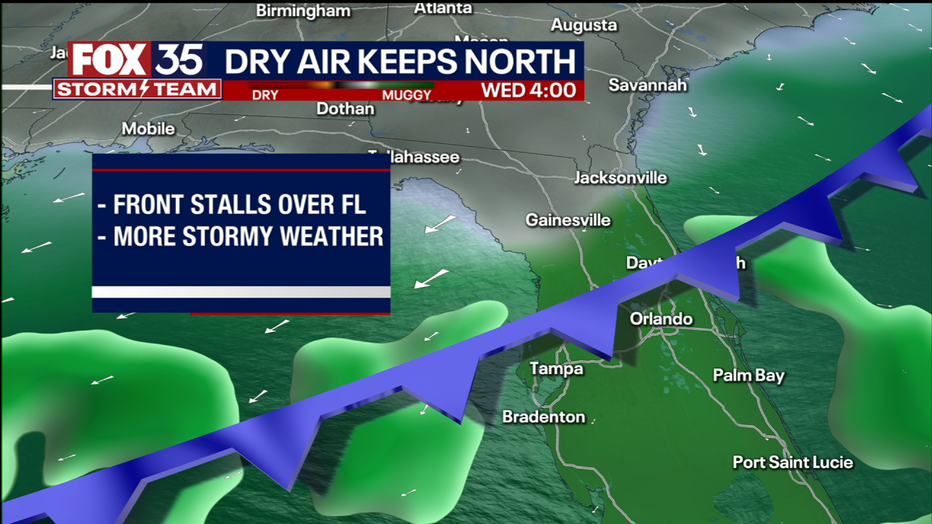
No big changes this week with more daily storm chances and plenty of tropical air. A front sinking South into Florida, combined with tropical moisture, will drive the daily rain opportunities.
TROPICS
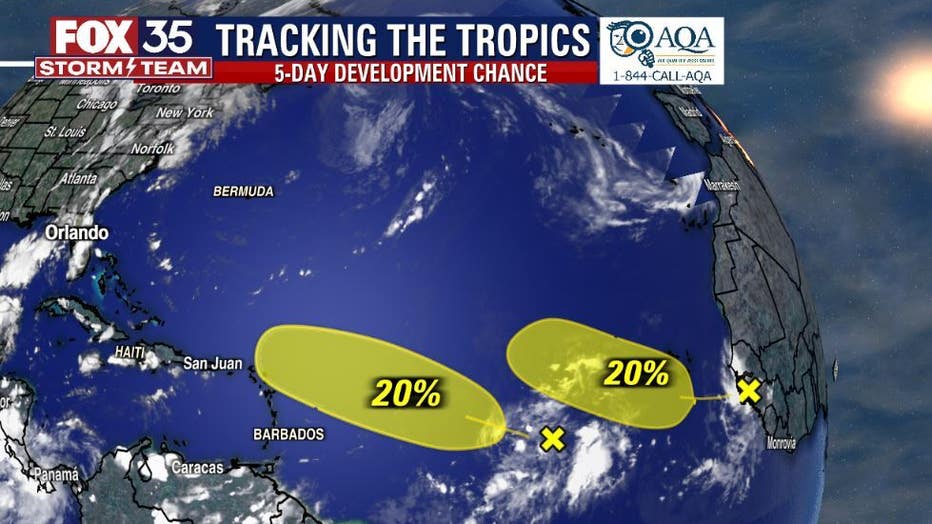
The FOX 35 Storm Team is tracking two tropical waves over the distant Atlantic. Both have low odds of developing over the next five days.
Track the tropics in real-time on the FOX 35 Storm Team weather app.