

After record highs this weekend, Florida will cool down and get wet

Weather Report: March 1st
FOX 35 meteorologist Jayme King gives the latest on the weather in Central Florida.
Orlando, Fl - After a very toasty Central Florida weekend, the heat remains in play on March 1st.
Expect area highs near record levels for some Central Florida locations.
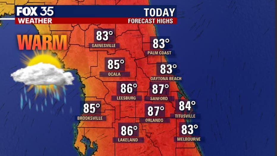
Skies will feature a blend of sun and clouds. Rain chances are slim and around 10 percent or less in Orlando, near 30 percent around Gainesville.
WEATHER ALERTS: Download the FOX 35 Weather App for live radar, severe weather alerts, and daily forecast reports on your phone
Looking at the record high temperatures for Leesburg, Sanford, and Orlando on Monday, the heat will definitely be on and records could be tied or even broken.
The communities with the best record potential will be Sanford and Leesburg.

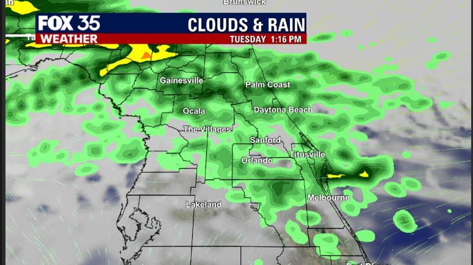
The latest forecast modeling is showing showers returning to the area by Tuesday.
Not much thunder is expected but showers could bring some decent rain coverage by late morning through the afternoon hours.
This will be round one of rain as we head through the week.
Round two of rain arrives on Wednesday as a strong front enters the state from the north.
The front will shove the warm weather's high-pressure center out of the way, allowing for a rise in storm coverage on Wednesday and then eventually cooling temperatures for both the day and night after the mentioned front slides through.
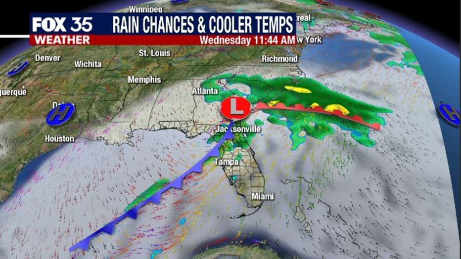
Expect highs behind the front to return to more typical readings for this time of year. This means highs in the low-70s and lows tumbling back into the 50s.
MORE NEWS: Forecasters may start hurricane season early this year: Here's why
On Saturday of the coming weekend, an area of low pressure is forecasted to move out of the Gulf of Mexico and towards Florida.
Some forecast models bring in some very wet conditions and the possibility of a few stronger storms.
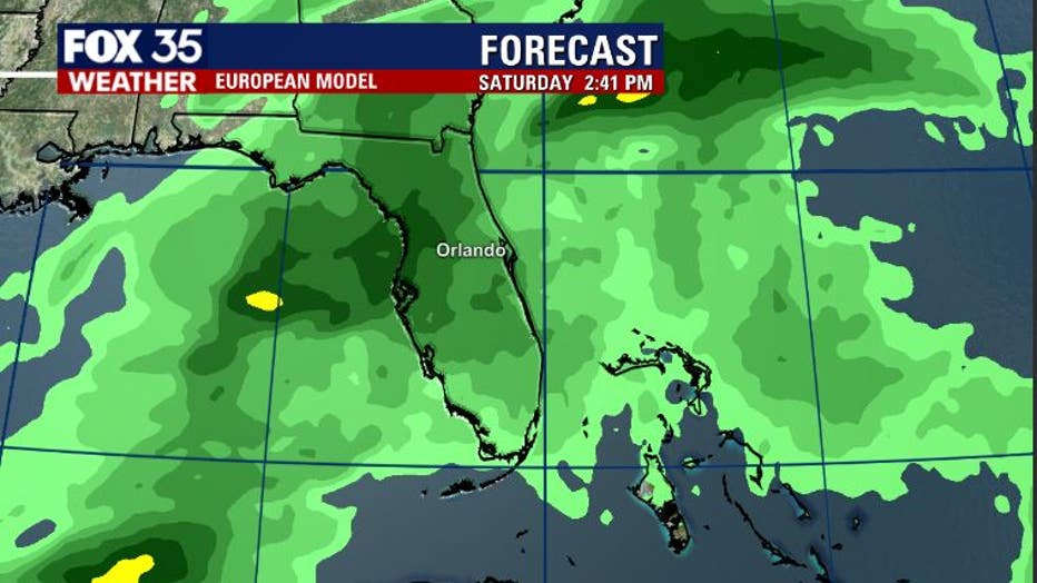
FOX 35 will monitor this throughout the week so stay with us for details.
Tune in to FOX 35 Orlando for the latest weather updates.