

Rain soaks Central Florida before beautiful weather, cooler temps move in

Orlando, FL - A cold front is working through Central Florida on Wednesday morning.
Showers and storms are plentiful for early to mid-morning with beautiful weather following up right behind the departing system. Rain chances will fall quickly after 9 a.m. around Orlando and points North.
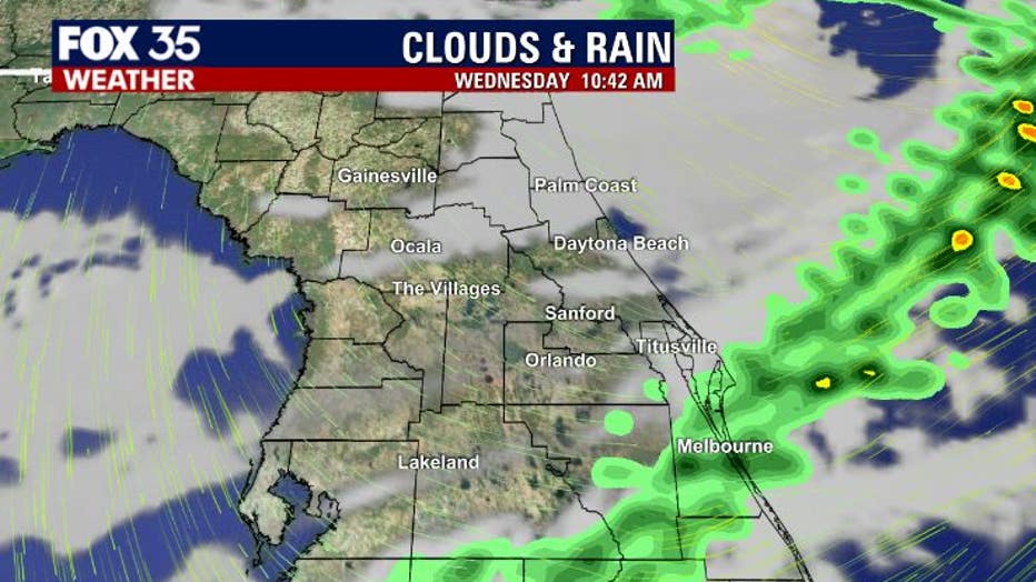
Lingering showers can be expected in South Brevard County up to about lunchtime with clearing there as we head into the early afternoon hours.

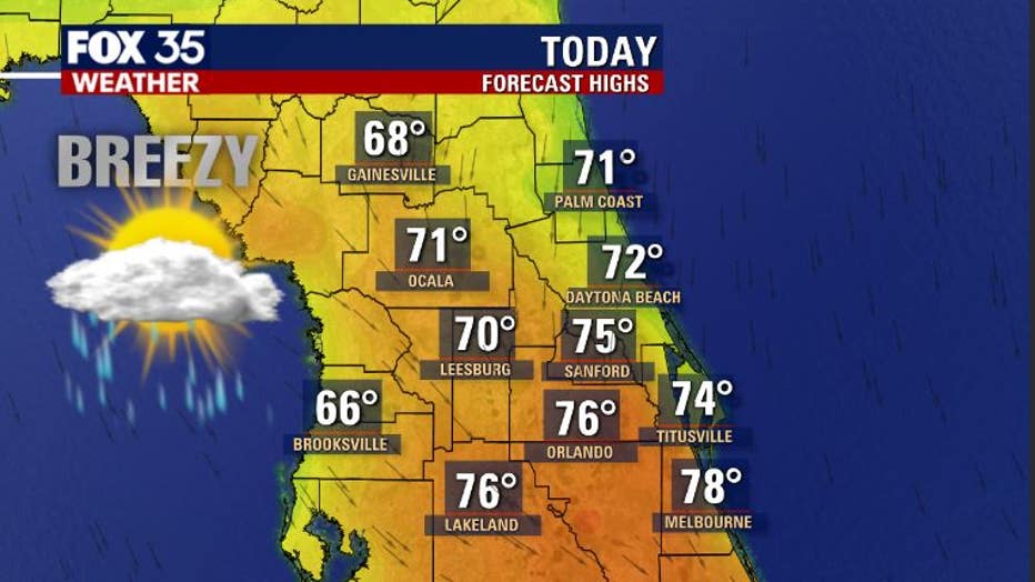
Our outdoor comfort index settles at about an 8 today. The front will scour out the clouds and moisture so things should be looking and feeling great by this afternoon.
Expect highs to remain in the 70s around Orlando, perhaps a few areas in North Central Florida staying in the cooler 60s.
WEATHER ALERTS: Download the FOX 35 Weather App for live radar, severe weather alerts, and daily forecast reports on your phone
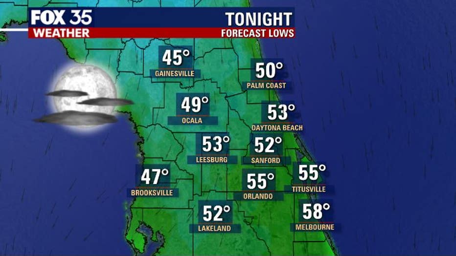
Tonight, it gets really nice! Lows tumble down into the 40s in isolated spots, 50s for the majority of Central Florida locations. Skies will feature a few clouds overnight and quiet conditions.
RELATED: Forecasters may start hurricane season early this year: Here's why
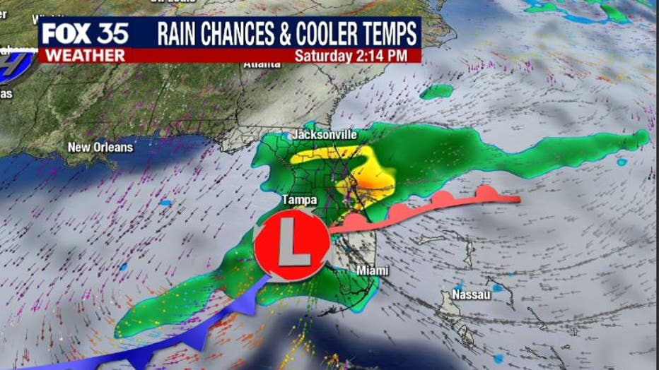
The next rain maker arrives on Saturday as low pressure moves in from the Gulf of Mexico.
As of right now, it looks like showers beginning Saturday morning with a few isolated storms Saturday afternoon. This system could produce quite a bit of rain on Saturday so maybe have a plan "B" if you have plans outdoors. Behind this front, the weather for Sunday looks amazing with highs in the 60s, breezy winds, and loads of sunshine.
Watch FOX 35 News for the latest weather updates.