

2 systems developing with just days left in 2020 hurricane season

ORLANDO, Fla. - The very active 2020 Atlantic hurricane season ends Monday and we are watching two systems for possible development.
A non-tropical area of low pressure is located several hundred miles southeast of Bermuda.
According to the National Hurricane Center, development is unlikely during the next day or so due to unfavorable upper-level winds.
"Environmental conditions are expected to be only marginally conducive for development during the next day or so as the low moves northeastward before it is absorbed by an approaching frontal system over the north-central Atlantic."
WEATHER ALERTS: Download the FOX 35 Weather App to track the tropics on your phone, receive severe weather alerts, and get the latest daily forecasts
Chances of development are at 30% over the next 2 days.
Another non-tropical area of low pressure is expected to form over the far eastern Atlantic during the weekend.
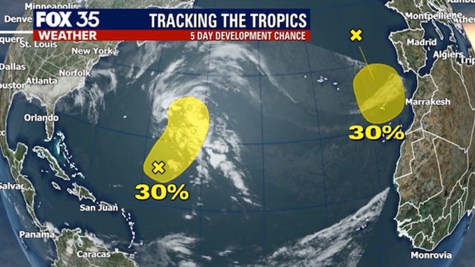
The NHC says the system could gradually gain subtropical characteristics early next week while it moves slowly southward to the west and southwest of Portugal. So far, development chances over the next 5 days remain low at 30%.
This hurricane season has been one for the record books with 30 named storms forming this season.
Meanwhile, the first big cold front of the season for Central Florida is just days away.
MORE NEWS: Forecast: Central Florida to drop into the 30s, 40s next week
Look for a dramatic fall in local temperatures for both day and night for much of next week. By Monday and Tuesday, we could see some of the coldest air in our area since last January and February when parts of Central Florida drop into the 30s and 40s.
Watch FOX 35 News for the latest weather developments.