

NHC: 2 disturbances flagged in the Atlantic, Gulf for possible tropical development
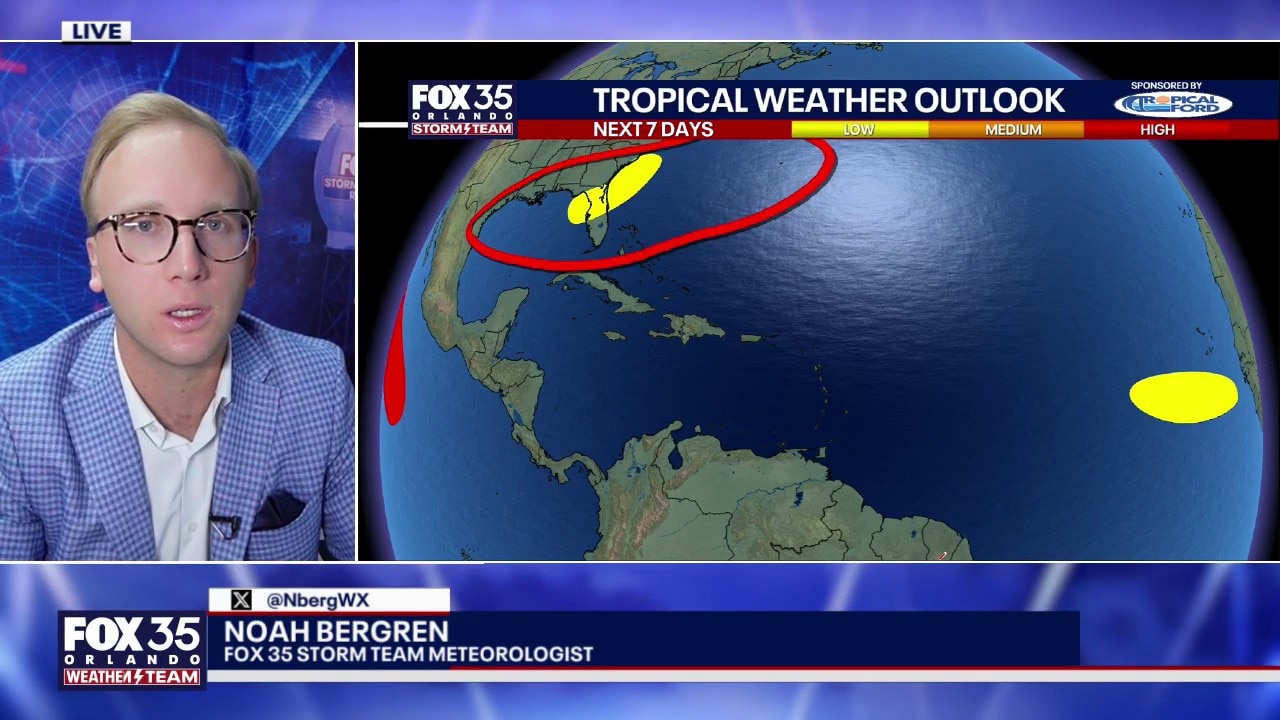
Tropics forecast: 2 disturbances tracked in Gulf, Atlantic
The National Hurricane Center is monitoring 2 disturbances in the Gulf and the Atlantic. FOX 35's Noah Bergren has the latest on their tropical development potential and if any of them could bring rain or other impacts to Florida.
ORLANDO, Fla. - The National Hurricane Center has designated two areas of interest in the Gulf and the Atlantic Ocean for potential tropical development. So far, both areas have been given low odds of development.
Disturbance in the Gulf near Florida, Georgia
Timeline:
An area of low pressure is expected to develop over the Gulf this weekend and slowly move towards the southeastern U.S., including Florida. As it moves across the Gulf, there is a low chance of tropical development, the NHC said.
Development odds: 20%
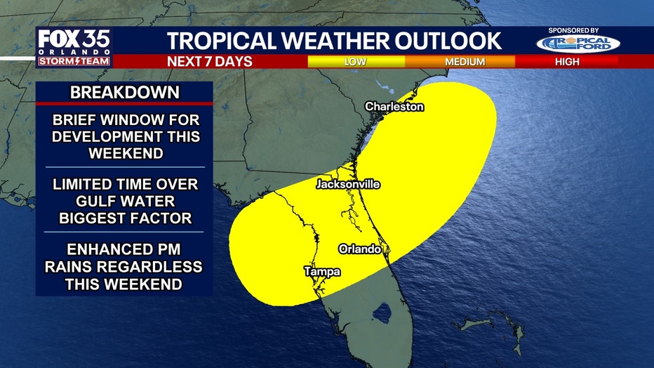
How close the low pressure forms to land is still uncertain, which will be a big player in further development and organization.
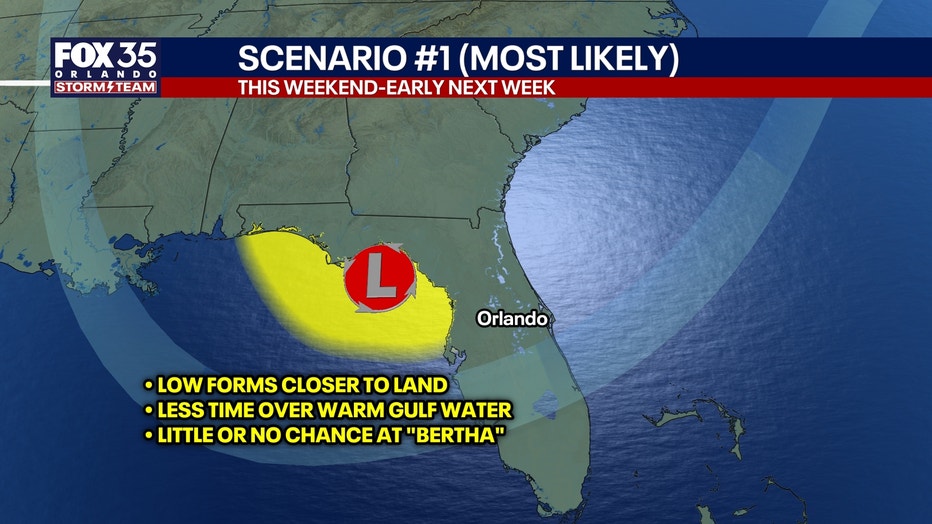
The closer to land a low pressure forms, the lower the likelihood of further tropical development. The farther away from land the low pressure forms, the higher the chances of tropical development since water, especially warm water, fuels tropical activity.
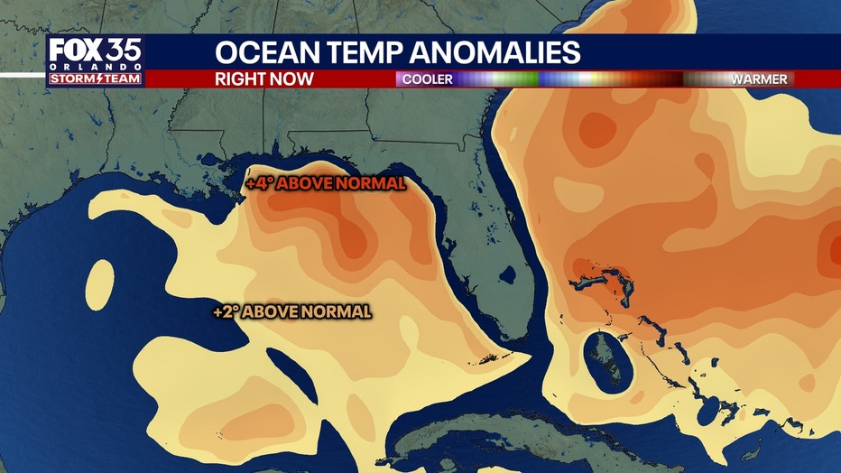
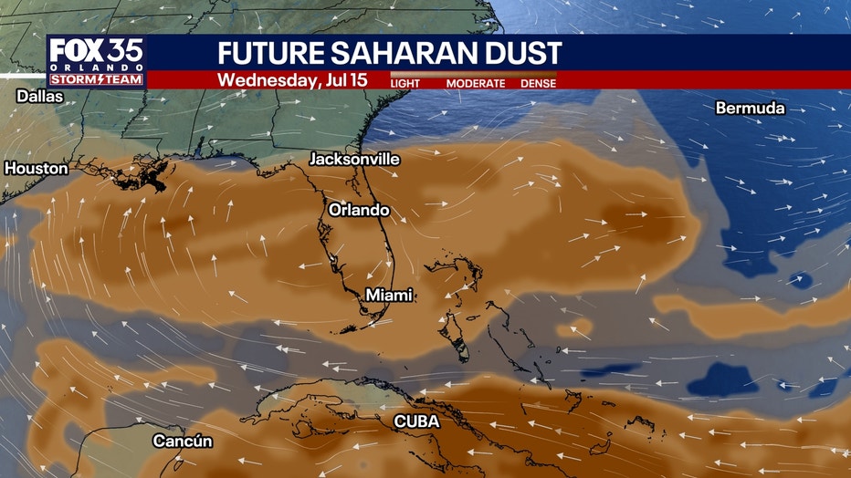
And while Gulf waters are warm, the presence of Saharan dust and wind shear are factors that could prevent and limit development as well.
Second disturbance in eastern tropical Atlantic
The NHC flagged a second disturbance in the eastern tropical Atlantic, south-east of the Cabo Verde Islands. Showers and thunderstorms in this area have become better organized within the last 24 hours, the NHC said.
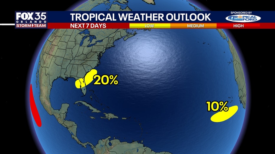
Some development is possible as the system slowly moved north-west across the ocean, the NHC said, though development odds are low. It's expected to enter an environment that should prevent it from developing further.
Development odds: 10%
Any impacts on Florida?
Low pressure aloft is going to form over the eastern Gulf, which means a strong push of tropical, humid, moisture-laden air from the SW into the Florida Peninsula.
Ample and widespread downpours and storms are expected Friday, Saturday, Sunday, and Monday afternoons and evenings into early next week. Some places could get 5 inches or more of rain between Friday and Monday added together.
The chance of a tropical system forming in the Gulf while not zero, is low. We will watch model trends and the satellite to see if anything changes.
Scenario 1
Low pressure forms too close to the coast of Florida. Jet stream not as far south in the Gulf.
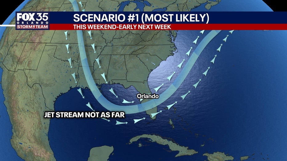
This means that the chance of a tropical storm forming is pretty marginal if at all. This is the more likely scenario.
Scenario 2
Low pressure forms further out over the very warm Gulf waters, meaning a better chance at a tropical system to form.
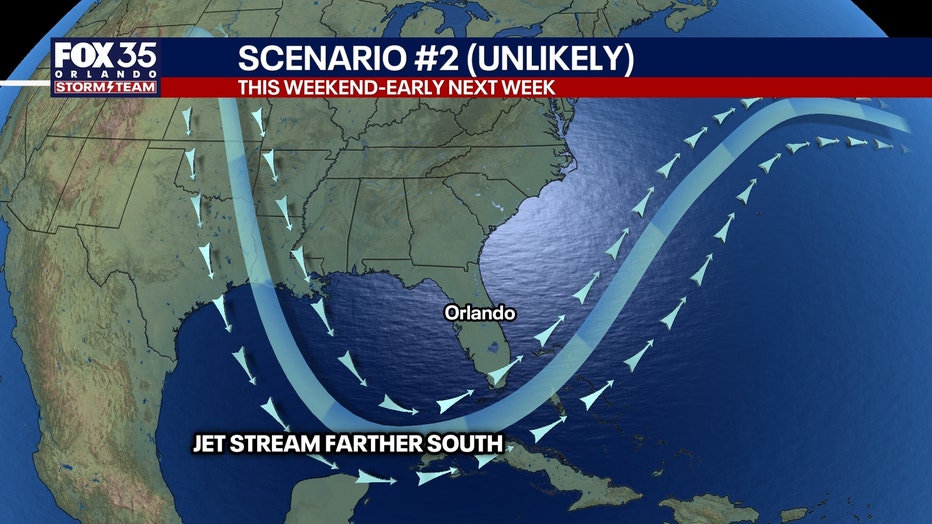
Longer time spent over water means a higher chance a tropical storm or more forming.
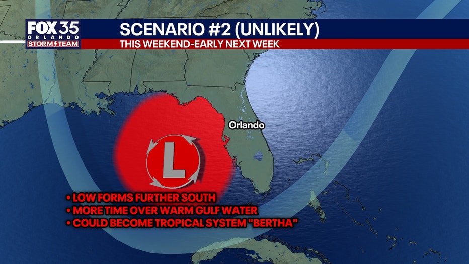
This scenario seems unlikely for now — but a handful of models show this.
The take-home message
Regardless of tropical development or not in the Gulf, enhanced daily downpours, showers, and storms Friday through Monday.
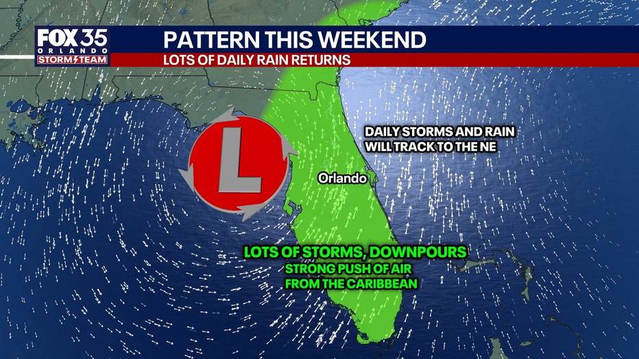
With more wind energy in the atmosphere this weekend, there may be a better-than-normal chance than typical rainy season stuff for some severe storms or brief tornado warnings.
The Source: The information in this story was provided by the FOX 35 Storm Team.