

National Hurricane Center: Hurricane Imelda impacts felt on East Coast as storm strengthens on path to Bermuda

Tropical Update: October 1, 2025
FOX 35 Storm Team Senior Meteorologist Noah Bergren is tracking Imelda moving away from the United States. Hurricane season runs through the end of November.
ORLANDO, Fla. - Although Hurricane Imelda will not make landfall in the U.S., the effects of the storm are being felt up and down the East Coast from the Southeast through the mid-Atlantic and into the Northeast and New England.
On Wednesday, residents of Bermuda rushed to complete preparations ahead of likely hurricane conditions as strengthening Hurricane Imelda races toward the island, bringing with it a dangerous storm surge, massive waves and coastal flooding.
Tracking Hurricane Imelda
What we know:
As of Wednesday evening, Hurricane Imelda was located about 190 miles west-southwest of Bermuda.
CLICK TO DOWNLOAD THE FOX LOCAL APP
The National Hurricane Center (NHC) says Imelda was moving toward the east-northeast near 22 mph. A much faster east-northeast to northeast motion was expected over the next couple of days.

On the forecast track, the core of the hurricane will be near Bermuda Wednesday afternoon or evening and move away from the island by Thursday afternoon.

Forecasters said the hurricane had maximum sustained winds near 100 mph with higher gusts, making it a Category 2 storm. Hurricane-force winds extend outward up to 60 miles from the center, and tropical-storm-force winds extend outward up to 255 miles. The estimated minimum central pressure of the storm is 966 mb.
A Hurricane Warning is currently in effect for Bermuda. A Hurricane Warning means that hurricane conditions are expected somewhere within the warning area.

Residents of Bermuda were rushing to complete preparations ahead of likely hurricane conditions on Wednesday. Imelda is expected to bring dangerous storm surge, massive waves and coastal flooding.
Although Hurricane Imelda will not make landfall in the U.S., the effects of the storm are being felt up and down the East Coast from the Southeast through the mid-Atlantic and into the Northeast and New England.
Tracking Remnants of Humberto
What we know:
Meanwhile, the NHC said the remnants of what was once a powerful Hurricane Humberto have merged with a front in the Atlantic Ocean.
Forecasters said the system was moving toward the east-northeast near 23 mph and had maximum sustained winds near 70 mph with higher gusts. Tropical-storm-force winds extend outward up to 265 miles from the center.
Swells from Humberto are likely to cause dangerous surf andlife-threatening rip current conditions, affecting beaches of thenorthern Caribbean, Bahamas, Bermuda, and much of the east coast ofthe United States over the next several days.
The estimated minimum central pressure of the storm is 980 mb.
2025 Atlantic Hurricane Season
Dig deeper:
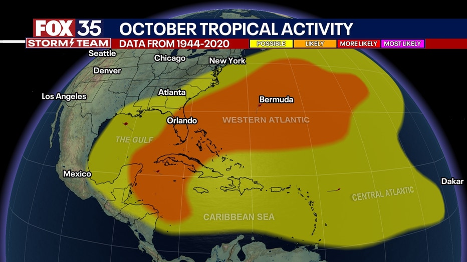
No other activity is being tracked in the Atlantic at this time, but now that we are in October, our focus will start to shift from activity in the central Atlantic to activity possibly brewing in the Caribbean and the Gulf.
The Central American Gyre is a low pressure system that forms over Central America and pulls in moisture from the Gulf, the Atlantic and the Pacific.

This annual pattern can lead to tropical activity in the back half of the season.
SIGN-UP FOR FOX 35'S BREAKING NEWS, DAILY NEWS NEWSLETTERS
The Atlantic hurricane season began on June 1 and runs through Nov. 30.
The Source: This story was written based on information shared by the National Hurricane Center (NHC), FOX Weather and the FOX 35 Storm Team on Sept. 30, 2025.