

Orlando Weather Forecast: Showers, storms possible Monday in Central Florida

Orlando Weather Forecast: March 12, 2023
FOX 35 Storm Team Meteorologist Ian Cassette has a look at Sunday's forecast.
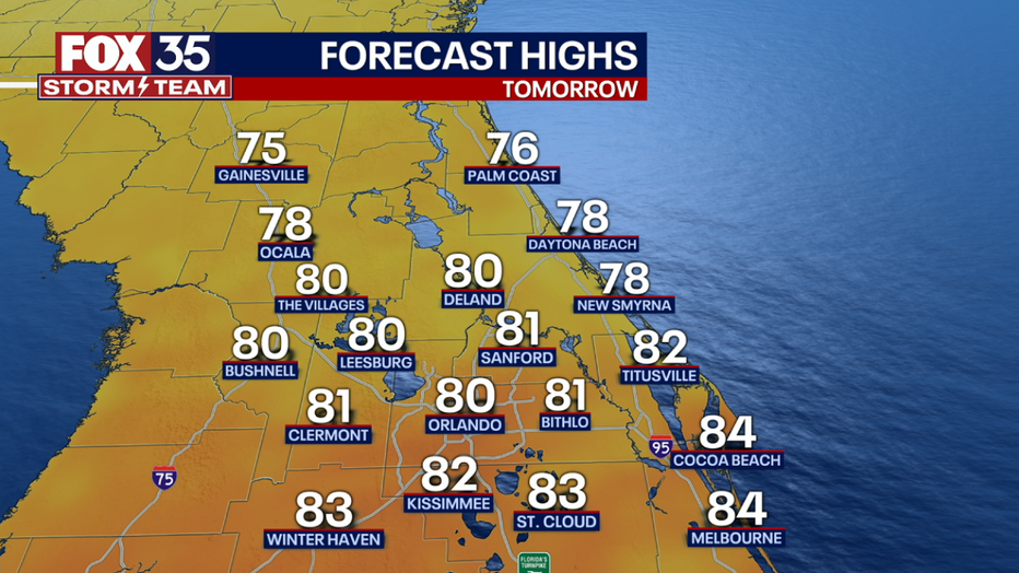
ORLANDO, Fla. - Today's high: 87 degrees
Tonight's low: 69 degrees
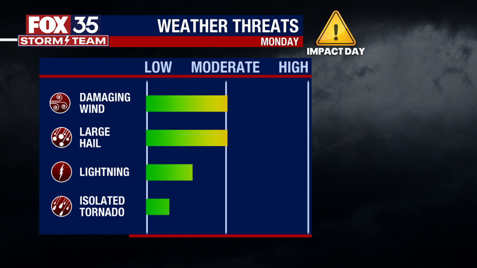
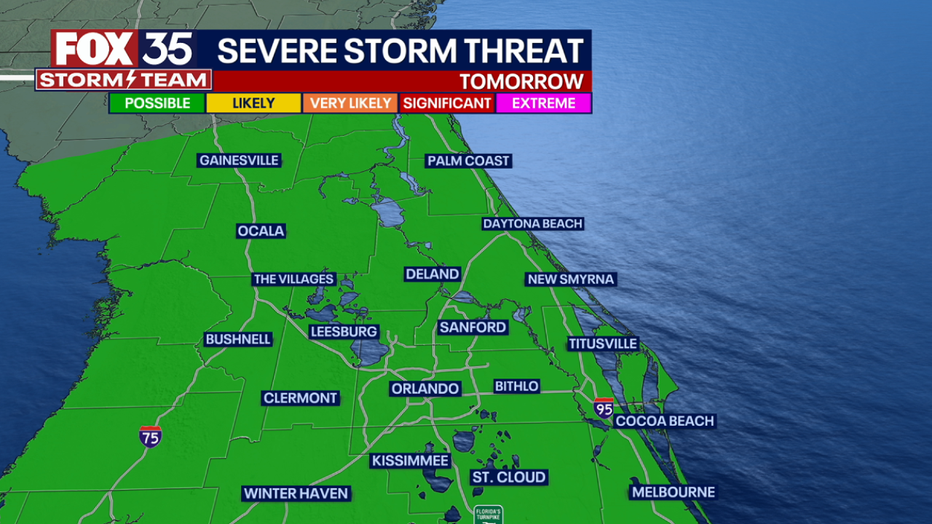
Main weather concerns: A potent cold front will continue to sink south tonight. This could lead to isolated storms over far northern parts of our area (Alachua, Dixie, Gilchrist, etc.). Severe weather can not be ruled out tonight in these areas. Storms may linger into Monday morning farther to the south bringing a wet start to the day for those north of I-4. Better storm chances arrive for Central FL by the afternoon as the cold front pushes through our area. The main risks will be damaging winds, large hail, lightning, heavy rain, and an isolated tornado.
BEACHES: Another sunny day at the beach with warmer temperatures than Saturday. Due to a system in the Atlantic there will be a large swell again today that will bring a HIGH rip current risk. It is not recommended to swim during this time.
THEME PARKS: Dry weather returns to the parks, but it will be a warmer day with highs near 86 degrees in the afternoon. Don't forget the sunblock!

OUTLOOK: A strong front arrives Monday and likely will bring us a chance of showers and a few storms. Coverage looks best in the afternoon with a chance of severe weather as well.
After the front rolls through, expect cooler weather with highs in the 60s and 70s Tuesday through Thursday and lows back in the 40s and 50s the rest of the week.