

Orlando weather: Pop-up, isolated showers and thunderstorms through the evening

Orlando PM Weather Forecast: June 21, 2025
Meteorologist Laurel Blanchard breaks down the rest of our weekend and times out the storm chances across Central Florida. The heat and humidity are the other big headline. Tune in to see how hot our temps get!
ORLANDO, Fla. - Today is not only the longest day of the year, but it's also the first full day of summer!
Here's a look at what to expect from the weather to finish off our Saturday in Central Florida, as well as a preview of what's to come tomorrow and heading into the workweek.
What will the weather look like tonight?
What To Expect:
Through the rest of the afternoon and evening, a few isolated showers and thunderstorms will pop up along with the seabreezes. Thes will be mainly across the central part of the peninsula.
If storms do fire up, heavy rain, gusty winds and frequent lightning are the main threats if you get caught in one of the isolated storms.
The showers and storms should fizzle out by 8 p.m. with lows in the lower-to-mid-70s tonight.
Tonight's sunset will not take place until 8:30 p.m.
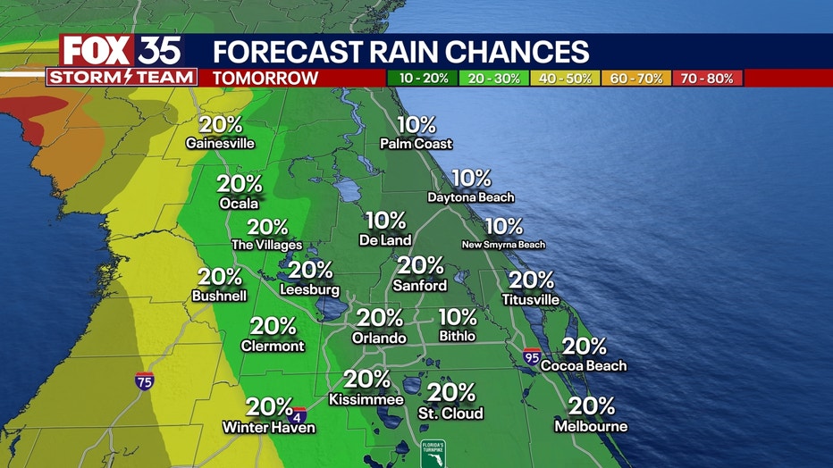
What will the weather look like tomorrow?
What's next:
Because of high pressure dominating to our Northwest, it is pushing in drier air, limiting our chances of rain for the rest of the weekend and cutting the humidity.
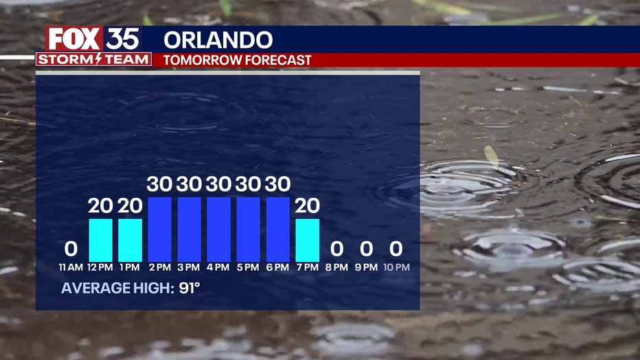
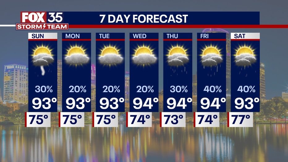
Spotty showers and storms will pop up on Sunday afternoon off the seabreeze, possibly bringing a few showers or a stray storm into Orlando.
The highs will stay in the low-to-mid-90s. Overnight, it'll be mainly dry and muggy with temperatures in the mid-70s.
High pressure is going to dominate the weather pattern going forward and will funnel dry air into the region, keeping our rain chances limited but not zero. This will also really jack up the heat heading into next week.
What will the weather look like next week?
Dig deeper:
Next week, we are looking at a rinse and repeat forecast with rain chances staying very spotty.
A heat dome will build across the mid-east coast, and this will really turn up the heat.
Here in Central Florida, highs will reach the mid-90s next week with a heat index well in the triple digits.
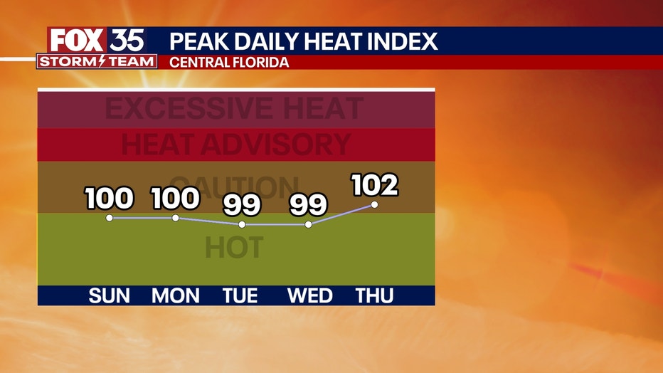
This ridge in the atmosphere starts to breakdown later in the week, popping our rain chances up a little more by Thursday and Friday.
FOX 35 Storm Tracker Radar and Live Weather Cameras
Track live when storms move across your area using the FOX 35 Storm Tracker Radar below. You can also watch as heavy rain moves across Central Florida on our Live Weather Cameras' page here.

More radar maps from FOX 35 Storm Tracker Radar
- Brevard County
- Flagler County
- Marion County
- Osceola County
- Orange County
- Polk County
- Seminole County
- Sumter County
- Volusia County
- U.S./National Radar
STAY CONNECTED WITH FOX 35 ORLANDO:
- Download the FOX Local app for breaking news alerts, the latest news headlines
- Download the FOX 35 Storm Team Weather app for weather alerts & radar
- Sign up for FOX 35's daily newsletter for the latest morning headlines
- FOX Local: Stream FOX 35 newscasts, FOX 35 News+, Central Florida Eats on your smart TV
The Source: This story was written based on information shared by the FOX 35 Storm Team on June 21, 2025.